2 MICHAEL WAY
Owner Information
ZHOU, JIN
2 MICHAELS WY
HOPKINTON, MA 01748


Property Details
2 MICHAEL WAY is classified as a Single Family Residential (Colonial).
The primary structure on this property was built in 2001. There are 4,760ft2 of built area within this property. There is 2,744ft2 of residential/living space within this property. This property is listed as having 8 rooms.
2 MICHAEL WAY is valued at $632,500. The land is valued at $233,300 and the structures are valued at $399,200.
This property is in Zone RB. Confirm with local Zoning Board authorities to ensure there are no overlays or other easements on this property.
The most recent deed for 2 MICHAEL WAY is recorded at the local registrar in Book 65276, Page 304. 2 MICHAEL WAY was last sold on Tuesday, April 28, 2015 for $515,000.
Assessment data from fiscal year 2022.
Flood Data
According to the FEMA National Flood Hazard Layer, this property does not appear to be in a flood zone. It may also be in an area not yet reviewed. Nonetheless, confirm this information prior to taking any action.
To view the flood hazards around this property, create a FEMA "Firmette" Map of the area around 2 MICHAEL WAY.
Broadband Internet Providers
| Provider | Type | Bandwidth (mbps) | |
|---|---|---|---|
| T-Mobile | Fixed Wireless | 25 | 3 |
| HughesNet | Satellite | 25 | 3 |
| VSAT Systems, LLC. | Satellite | 2 | 1 |
| GCI Communication Corp. | Satellite | 0 | 0 |
| Crown Castle Fiber | Fiber | 0 | 0 |
| Viasat Inc | Satellite | 100 | 3 |
| Verizon New England Inc. | DSL | 7 | 0 |
| Verizon New England Inc. | Fiber | 940 | 880 |
| Comcast | Cable | 1000 | 35 |
Broadband service provider data from December 2020.
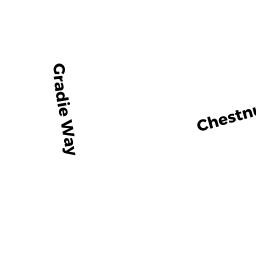
Adjacent Properties
- 1 MICHAEL WAY
Single Family Residential owned by GORMAN, MARK P. - 1 WILD ROAD
Single Family Residential owned by HOSSAIN, MAHMUD - 3 CHESTNUT STREET
Single Family Residential owned by BARTLETT, RICHARD J - 1 CHESTNUT STREET
Single Family Residential owned by NEALON, PATRICK SULLIVAN - 181 HAYDEN ROWE
Single Family Residential owned by HAINES, DAVID R. - 179 HAYDEN ROWE
Two-Family Residential owned by JONES, THOMAS L.,III